On Undersea Cables, Historic Routes, Railroad Gauges and Horses' Asses
I once read a story sent through an email chain which I've seen pop up every now and again, which asserts the fact that two horses standing side by side are roughly 5 feet apart is the reason that is the standard gauge of railroad tracks is 4'8 1/2".
 |
| Created with Bing AI |
It isn't true, or at the very least there's far more that can be said on how standard gauge came into being. For example, the Southern Railway had a 5' gauge originally.
I found this from a Trains forum posts which is one of a few of these stories to go around. I apologize in advance for the rough editing.
Railroad gauge
Why was that gauge used?
Because the first rail lines were built by the same people who built the pre-railroad tramways, and that's the gauge they used.
for fear of destroying their wagon wheels.
is derived from the original specifications for an Imperial Roman war chariot.
The railroad line from the factory happens to run through a tunnel in the mountains and the SRBs had to fit through that tunnel.
of what is arguably the world's most advanced transportation system was determined over two thousand years ago by the width of a horse's ass.
Explains a whole lot of stuff, doesn't it?
The space shuttle bit is complete nonsense, but the larger point of Roman roads being roughly standard gauged size today holds a bit more water. Once again, this isn't entirely true, but it isn't entirely wrong either, in the sense that earlier forms of transportation leave their mark on future generations. To me, this is even more fascinating, if far less funny. The Roman Roads of Britain were largely reused, although there are some paths that you can still only find on maps. (Someone ought to make a map of these..!)
 |
| Here's an example of an abandoned Roman Road just south of Kings Somborne. Map from National Library of Scotland. |
In the US, the original Auto Trails were created from military routes and plankroads which were themselves largely created and improved versions of old Native American transportation routes. The earliest US Highways used and expanded these networks, and the same holds true for the Interstate Highway System. Railroads are no different, and either built up infrastructure and created their own towns, or built their routes adjacent to existing roads.
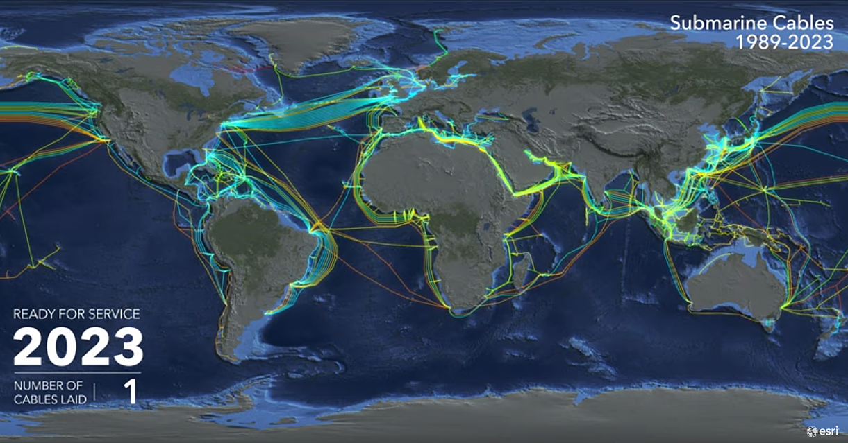
But I didn't realize how far that connection existed until I read the opening paragraphs of Internet for the People, which was an excellent book on its own, mentioned early that the location of undersea cables today has a direct correlation to the shipping networks from centuries ago, as the locations of undersea telegraph lines were directly located near the ancient shipping routes.
In the early days of trade, shipping networks played a crucial role in connecting countries and cultures. These networks were primarily based on ocean currents and wind patterns, with ships using these natural forces to navigate the seas. As a result, certain ports and shipping routes became more popular than others. For instance, the Mediterranean was a critical trading hub in ancient times, connecting Europe, Africa, and Asia. Similarly, the Silk Road connected China with the Middle East and Europe, facilitating trade and cultural exchange.
Of course, data transportation is no different that physical transportation, just on a much smaller and fast scale. Today's undersea cables are the backbone of the internet, allowing data to be transmitted across continents in real-time. These cables carry more than 99% of international data, including emails, social media messages, and financial transactions. They connect people, businesses, and governments, enabling instant communication and collaboration.
 |
This website shows an interesting visualization of the growth of undersea cables over time. |
So the story of two horses pulling a cart side by side being the catalyst for standard gauge rails today might not be true, but the idea that transportation history's past plays a role in our current world, not only in transit networks but even the location of data infrastructure, is most certainly so, and I think that's an incredible realization.
This correlation highlights how the location of one transportation source can have ramifications for future generations. The shipping routes of the past influenced where undersea cables were laid, impacting economic development how globalization would flourish. And indeed, as the world becomes ever more interconnected, it's essential to recognize how transportation networks from the past continue to shape the present and future, even if the story of the standard railroad gauge is more of a story of horse manure than of the size of its ass.
Thanks as always for reading!


Comments
Post a Comment