Posts

Showing posts from 2022

The Pontchartrain Railroad: Louisiana's First Railroad

Image
In 1831, the third common carrier railroad opened in the United States, following the B&O Railroad  in 1828 and the South Carolina Canal and Railroad Company  in 1830, which operated the first scheduled passenger train. This railroad would service the bustling city of New Orleans, Louisiana , connecting the Mississippi River to Lake Pontchartrain along a roughly six mile route. It's hard to understand just how new railroad technology was at this time, as while New Orleans wanted a railroad, the initial construction of the railroad perplexed its builders, most of whom had yet to see one operate. "Many problems confronted the builders; few of them had ever seen a railroad, and none had any but vague ideas about the construction and operation of one. Perplexing questions had to be solved. Were the coaches to be furnished with springs? Were iron or wooden rails to be used? Were the swamps over which the line was to run to be bridged or the land to be filled in for a permanent ...

Ancient Courses of the Mississippi River Map

Image
One of the most fascinating maps I’ve seen are the Ancient Courses of the Mississippi River by cartographer  Harold Fisk for the Army Corps of Engineers . The maps (they run up and down the Lower Mississippi River), show the present (c.1944) course of the river, as well as how that course has changed over time through stages.  The Mississippi River has not remained static over time. It has been constantly shaped by natural forces such as erosion, sedimentation, floods, earthquakes, natural and anthropogenic climate change, tectonic movements, and glacial cycles. These forces have caused the river to change its course, width, depth, and speed over time. The river changes course continuously, as do all rivers. Along the way from Lake Itasca, MN to the Gulf of Mexico, the Mississippi River shapes the landscape, culture, and history of 10 states and countless communities. But how did this mighty river come to be? And how has it changed over time? These maps help to answer that que...

Ghost Bridge Piers of a Former Railroad Line in Lemont, IL

Image
Looking from the Lemont Road Bridge east towards  this bridge in Lemont, IL , you’ll see bridge piers in front of it, just to the railroad bridge's immediate west, which hold no tracks or road. Despite their redundancy, they're quite easily visible So why do these piers exist, and what was the bridge they used to carry used for? From what I’ve been able to tell, they are remnants of a former bridge which once stood here (over the Des Plaines River), before the Sanitary & Ship Canal was built. The Metropolitan Water Reclamation District  built the currently standing bridge around 1900. This bridge carries the BNSF Chillicothe Subdivision .  Note the piers in the foreground. FRRandP photo. My initial thought was that they were simply bridge piers from an earlier mainline bridge, except that didn't appear to be the case, as the piers have been there since at least 1938. It turns out that my initial thought was true, but I was wrong on the reasons why the piers remai...

Route 60: The Original Number of Route 66

Image
US Route 66 was one of the original US Highways , being designated in 1926 along with the rest of the original routes. But before its designation, there was a tremendous controversy over its numbering, as there were over numerous highways early on in the system's creation. Because of this, you almost got your kicks on Route 60. Missouri Highway Map, c.1926 showing the proposed US-60 through the state. Like with any government project as vast and complex as the US Highway System, it is the product of numerous compromises and debates over numberings, routings, alignments, costs, and numerous other whims of those in Congress who ultimately approved the system. In the early 1920's, the named Auto Trails were giving way to a network of then-modern highways to connect the nation through automobiles as the railroads had done decades earlier. 1926 Illinois State Highway Map , showing US-66 as IL-4 still. By 1928 , US-66 was added to the map. The numbered system would have the longes...

The St. Clair River Pontiac & Jackson Railroad: An Unbuilt Mystery

Image
For the better part of the last year, I've been stuck trying to figure out what appeared to be the trace of an abandoned rail line immediately west of Pinckney, MI, which is easily visible in the satellite imagery below. Google Maps image of the line west of Pinckney via our Abandoned & Out-of-Service Railroad Lines map . The line in question diverges from the right of way of the former Grand Trunk Railway line that is now part of the Lakelands Trail . The grading is fairly consistent for the first 10 miles of line, and then just stops around the Joslin Lake area, which led me to believe that it was either a long-forgotten ice house spur, just like the California Ice and Coal Company Line in Antioch, IL, or a logging railroad of some kind, of which numerous operated in the State of Michigan, albeit usually in the northern part of the Lower Peninsula. However, after being unable to find any information corroborating those theories, I finally came across what appears to be the R...

The Kansas City Clinton & Springfield Railway

Image
The Kansas City Clinton & Springfield Railway connected Olathe, KS with Ash Grove, MO along a 155 mile right of way .  KCC&S Steam Engine , c.1924. Springfield-Greene County Library. Built in 1885, it long paralleled the Kansas City and Southern Railway, which ran a quite similar route in spots. Eventually both lines became part of the St. Louis & San Francisco Railway (" The Frisco "), who would purchase the railroad in 1928, incorporating parts of the line into it's Kansas City-Springfield route, while abandoning most stretches by the mid-1930's. This section was deemed inferior and redundant to the better constructed right of way, leading to its abandonment. The 1894 USGS Clinton Map shows the routes running in parallel to each other, and offers a hint at how close these rights of way were, in some spots running beside each other. Interestingly, much of these parts of the route are underwater today as a result of the construction of the  Truman Reserv...

Should the RTA's Metra, Pace and CTA Branches Merge Together?

Image
An article I happened to stumble upon recently alluded to a significant problem in Chicago and the surrounding region's transit infrastructure; namely that it is split into three parts. It's one of those problems of our infrastructure that everyone seems to know, and yet is rarely discussed. Metra handles the regional commuter rail of the Regional Transportation Authority , on paper as the " Northeast Illinois Regional Railroad Corporation ". Rolls right off the tongue. Metra 213 at Blue Island, IL. Photographer: Frank Novak, 1986. FRRandP photo collection. Pace handles suburban bus service, with very few of its routes entering the City of Chicago. Many of Pace's routes, especially their longer routes, date back to the numerous suburban bus systems , which usually didn't interact with one another, with the exception of those routes which replaced interurban rail systems, like the Chicago and West Towns Railway . Pace Bus 6666 at Woodfield Mall. The CTA hand...

The Oil Belt Railway

Image
The Oil Belt Railway was a very obscure, and very short lived, short line railroad that ran from Oblong to Bridgeport, Illinois, beginning service in 1913. The track was slightly less than 25 miles long between the two towns in southeastern Illinois. A branch line to Lawrenceville was proposed from Bridgeport, but was never constructed. ( Right of way ) It interchanged with the Illinois Central Railroad at Oblong and the B&O Southwestern Railroad in Bridgeport. Despite not running until 1913, construction actually began along this road four years prior in 1909. The fact that it took four years to get this line running should be a good indicator of the line's typical operations throughout its life.  Right of way on the 1930 Crawford County Plat Map , over a decade post-abandonment. (Historic Map Works) A narrow-gauge operation, one of the very few that were never converted to standard gauge in the state, the line hauled grain and hay to local farmers in the area, as well as ...

Bagdad: A California Desert Ghost Town

Image
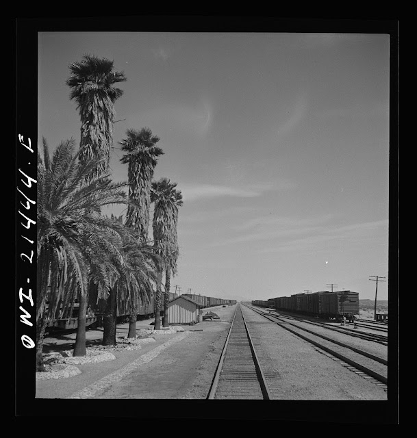
Bagdad, CA is another Route 66 ghost town  in San Bernardino County, CA. A product of the railroad, it would ultimately be superseded by Interstate 40, when 66 no longer functioned as a through route. However, this is not a tale of a town destroyed by a freeway or re-alignment, as this town peaked long before I-40 was built, the bypass was just another nail in the coffin. Like many nearby towns, it got its start in 1883 when the Atchison Topeka & Santa Fe Railway was built between Needles and Barstow, CA. During this time, it served as a stop for mining workers north and south of the area. Even at its peak, only a few hundred people called the town home. Towns built by the railroad usually were platted in 10 mile increments to allow steam engines to take on water, supplied by about 20 tank cars a day to replenish tanks in the area, which otherwise is completely dry being in the middle of the Mojave Desert.  The town is actually the US record holder for consecutive ...