Discovering an Old Railroad Bridge: A Quick Lesson on How Valuable LiDAR Data Can Be
It should probably come as no surprise that I love to learn about our transportation history, and one of the best ways to do that is to study satellite imagery, both current and historic. I've talked before about some of my favorite, free, resources to find such imagery.
But there's also another tool that comes in handy on occasion for finding bits of history you otherwise wouldn't have known about. Or that you knew about, but couldn't find. I'm referring to LiDAR data, which stands for Light Detection and Ranging Imagery.
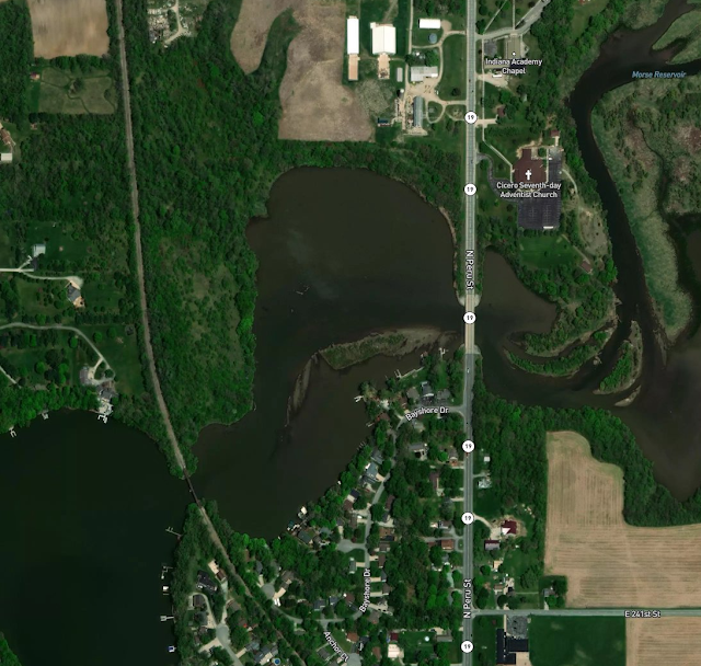
Let's take a look at the satellite image below of the area just to the north of Cicero, Indiana. Spot any abandoned rights of way? It's ok if you did not; I certainly would not have. There's an existent rail line through the Morse Reservoir, and that's all that appears to be visible.
 |
| Indiana Satellite Imagery just north of Cicero. |
But let's see what the Digital Terrain Model, or DTM, LiDAR data on the same area shows, and suddenly, another grade over the water is quite evident!
 |
| Indiana's LiDAR Data, Hosted by Purdue University. Hamilton County. |
Sadly, the interurban line has some unfortunate history just north of here, where a crash killed six people in 1910.
 |
| "Train Wreck near Tipton, IN, 9/24/1910." "Six people were killed on September 24, 1910 when two trains on the Indiana Union Traction line collided at the Ressler crossing two miles north of Tipton. Sadly, among those killed was a young man on his way to be married that evening in Tipton." (Indiana Historical Society) |


Comments
Post a Comment