Posts

Showing posts from April, 2021

The Ill-Fated Illinois Route 53/120 Project in Lake County

Image
It's been a few years since anyone has thought about extending Illinois Route 53 north of Lake Cook Road in earnest, and the project is all but dead . Facing an incredible cost, negative environmental impact, questionable need, and public opposition, I think it's ultimately for the best that road has not, and does not, get built. That is not to say that I do not support significant improvements in Lake County's roads, but I think this was the wrong solution to the issue. The Illinois Route 53/120 Project in Lake County, Illinois wass a proposed highway expansion project aimed at improving the existing Route 53 and Route 120 highways in the county, both of which are two lane roads today. Especially in Route 120's case, it is not designed to handle the traffic volume that occurs on it each day. The project has been in the planning stages for several years and its purpose is to address growing traffic congestion, safety issues, and improve access to economic opportunities ...

A Map of Abandoned Railroad Lines in the State of Illinois

Image
One of my future goals for mapping is to better visualize the data we have gathered over the last five years. To that end, I created a map of abandoned rail lines entirely for the State of Illinois!  Data is based on our interactive map .  © FRRandP, 2021 I am fairly confident I have discovered most, if not all, of the abandoned lines in the state, and will be creating static maps over time for other states as well! There are still many lines I haven't discovered across the United States, however, so the next states will likely be in the Midwest. That being said, even states like Wisconsin and Michigan have incredibly large swaths of forest where logging railroads once ran, and I cannot say for certain I have discovered all of them yet. But for now, enjoy this map of Illinois! 

The Cincinnati and Muskingum Valley Railroad

Image
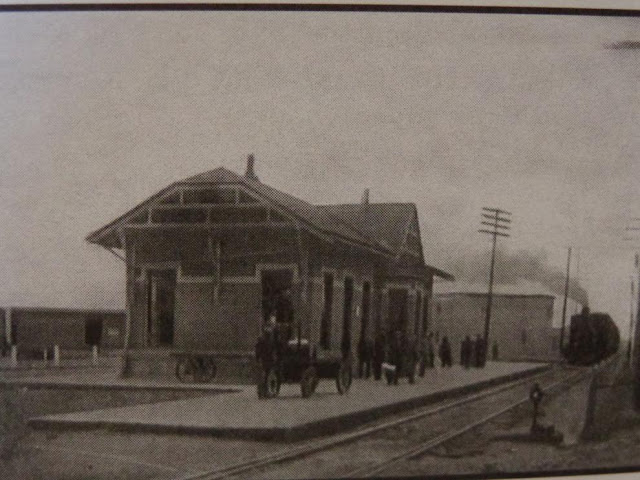
The Cincinnati and Muskingum Valley Railroad connected Trinway, OH with Morrow, OH. At Trinway, it seamlessly connected to Cleveland Akron & Columbus Railroad , of whom both lines were part of the Pennsylvania Railroad System . Cincinnati and Muskingum Valley Railroad Station in Circleville. Incorporated in 1851, the road began construction from Morrow and reached Zanesville five years later, reaching its full extent in 1870. After an 1863 foreclosure, it was reorganized as the Cincinnati & Zanesville Railroad, only for the Pennsylvania to assume control of the line seven years later, when it was extended to Trinway. It formally merged with the aforementioned CA&C Railroad in 1911. Right of way at the red arrow. Image: Map showing the route and connections of the Bellaire, Zanesville and Cincinnati Railway . Library of Congress The line continued to operate under Pennsylvania's control in its entirety until the 1950's, when passenger service was abolished. But by th...

The Wabash Moved On - And Now Ritchie's Gone

Image
In far southern Will County, IL, the Wabash Railroad once connected Chicago to downstate Gibson City, IL, passing through the small town of Ritchie .  Ritchie was a flag stop, meaning that passing trains stopped only if a flag indicated passengers were waiting at the station. The line was chosen and completed by the  Chicago & Strawn Railroad in 1880,  despite the fact that the Decatur & State Line Railway was graded, but never built, save for a few bridge piers in the river about five miles east.  It became part of the Wabash (or more specifically the Wabash St. Louis & Pacific) upon completion, known as the Forrest District . Situated on the Kankakee River , this alignment caused numerous derailments as a result of the curvature of the road; as such, the Wabash straightened the tracks north of the river just after 1900. This was not without at least some controversy, as the Ritchie station thrived when "a lot of people came from Chicago to go to Wesle...

The Chippewa Valley Electric Railway

Image
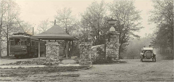
The Chippewa Valley Electric Railway connected Eau Claire, WI and Chippewa Falls, WI, both of which are located along the Chippewa River . The interurban was just over 11 miles in length. ( Right of way ) The CVRR largely paralleled two other rail lines, the Milwaukee Road and the Chicago & North Western, of which the C&NW trackage has also been abandoned, albeit much later, and much of that right of way has been converted into the Chippewa River State Trail. Irvine Park Station on the CVRR . Image: Chippewa County The following history of the interurban comes from History of Eau Claire County Wisconsin, 1914, Past and Present : "The Eau Claire Street Railway Company was organized and began running cars in 1879.  These were horse cars, but after a time mules were also used.  The road ran from Shawtown to the Omaha depot and followed the same streets it occupies today, except for a few months, when the present bridge over the Chippewa river was being constructed, when...

A Visit to the Door County Maritime Museum

Image
In December of 2018, we went to Door County, Wisconsin and visited the Door County Maritime Museum , located adjacent to the Sturgeon Bay and in the city of the same name. Sturgeon Bay and the Door County area as a whole were havens for shipbuilding, and even today is inextricably linked to the maritime industry. Ships being constructed at Sturgeon Bay. Notice all of the rails, which represented the end of the line of the Ahnapee & Western Railway. To put it mildly, Door County is much more gorgeous during the summer, but nonetheless, the museum was a very interesting visit, and we learned a ton about shipwrecks that have occurred in the Great Lakes. While the Wreck of the Edmund Fitzgerald was immortalized in the Gordon Lightfoot song , it is far from the only wreck to occur in the Great Lakes, and in fact there's a museum in Paradise, MI devoted entirely to shipwrecks that have occurred in these waters. From the DCMM, "The   Louisiana   was a steamboat constructed in M...

The Proposed Canada to Mexico Highway: US Highway 789

Image
US Highway 789 was a proposal for a border-to-border highway running from Nogales, AZ at the Mexican border, to Sweet Grass, MT at the Canadian border. It was dubbed the " Canada-to-Mexico Highway ". It was rejected by AASHTO , given that much of the route would use already existing US Highways (not that that's ever stopped them since). Nonetheless, each state (Arizona, New Mexico, Colorado, Wyoming, and Montana) was interested in a continuous route, and so each created or proposed a Route 789 in their state highway system during the early 1950's. Colorado's 789, sharing pavement with US-160 and the formerly numbered US-666 (now 491 ). Image:   Jim Lindsay In Arizona, AZ-789 was designated in 1956 . Over time, given the duplicative nature of the numbering, each state except for Wyoming chose to remove the 789 designation from their systems.  US 310 in Wyoming, along with WY-789, which was once proposed to be its own US Route. Image:  Jonathan Winkler via AARoads...