Posts

Showing posts from September, 2019

Queensland Rail's Cooktown-to-Laura Branch

Image
Otherwise known as the Cooktown Railway , The Cooktown to Laura line of Queensland Rail was an isolated railway line located in the far northern part of the Australian state, built between 1885 and 1888. The line was built following a gold rush, but by the time the line was complete, the area was in an economic downturn. Although the Australian Parliament had authorized a 48km extension of the line from Laura, it was never built, other than a bridge to nowhere over the Laura River, which was used occasionally for excursion trains, but nothing else. Bridge remains of the "bridge to nowhere" over the Laura River , near the site of Laura Village in Queensland. Image: Cape York Australia The line had numerous bridges in addition to the one over the Laura River. This one, over the Normanby River, is pictured below. Cooktown-to-Laura line crossing the Normanby River . It closed in the early 20th century, before being reopened under railmotor power in 1927. It closed permanently in...
The Montana Wyoming and Southern Railroad

Image
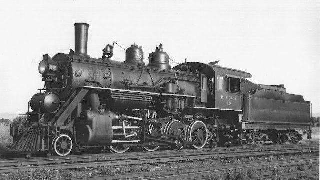
The Montana Wyoming and Southern Railroad was a short-line railroad in Carbon County, MT, completed in 1906 between Bridger, MT (where it connected with the Northern Pacific Railway ), and Washoe, MT, 23 miles southwesterly. It also served nearby Eagle, MT via a branch line. Yesteryear Depot 1930 image by Paul Eilenburger via SteamLocomotive It was built to be bought out by the NP, leaving investors with great returns, however it remained independent throughout its life, as NP did not want to deal with promoter Frank Hall, who had built an earlier competing line to the Northern Pacific.  Line of the Montana Wyoming & Southern on our Abandoned & Out-of-Service Railroad Lines Map Given that the line's only connection to the rest of the US rail network was through the NP, they nonetheless retained significant indirect control of the line. Map and caption from Something of a nuisance value: The Montana Wyoming & Southern Railroad, 1905-1953 The high grade coal of the area n...

The São Paulo Railway

Image
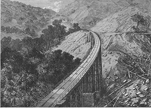
The São Paulo Railway (or St. Paul's Railroad in English) was first chartered in 1859 was hailed as an engineering marvel for its time. ( Right of way ) Serra Viaduct Incline  old Antique Vintage Print - Harper's Weekly, 1868 It began at Santos, a port south of São Paulo, Brazil, running twelve miles north to Piassaguera. From there, it headed to Paranapiacaba by a steep grade using cable power, before reaching the plateau, and once again relying on adhesion to make its way to São Paulo and eventually Jundiaí. Map of the São Paulo Railway, both abandoned and still in-service segments. The cable system was replaced by a rack-and-pinion railway in 1974. Serra Viaduct. Image: Marcus Marcellus, Google Photos The original right of way has been abandoned, but the line itself is still in service as part of the nationalized Rede Ferroviária Federal, Sociedade Anônima network. (RFFSA) One of the highlights of the old right of way was its many tunnels and viaducts. The most famous, Ser...

Ford City Drive Bridge

Image
In 1944, the Federal government built the Ford City Drive Bridge and interchange, along with a companion structure on Cicero Avenue to the west, to assist with the large amount of traffic generated from shift changes and other activity at the Dodge-Chicago Plant.  The bridge served traffic over Pulaski Road, and was instrumental in bringing traffic to and from the plant during World War II, and shoppers postwar, but has in recent decades become blighted and does not serve a significant amount of traffic anymore. The bridge is so intertwined with the history of the area that when explaining its history, that its almost easy to forget about. This should have qualified the bridge for historic status, and could have been rehabbed, however as of late 2020, it has been demolished. Despite its demolishment, its still easily viewable on Google Maps . Image: Nathan Holth, 2011 via HistoricBridges . The Dodge-Chicago Plant was used to build aircraft engines for the B-29 bomber as part of t...

Scanning Old Railroad Photos: Keeping Railroad History Alive

Image
In any industry, media preservation is an ongoing issue, particularly when it comes to film and photography. For example, many early Hollywood films have been lost to history. To its credit, the railroad industry has been quite proactive about keeping its history preserved, at least when it comes to the largest companies and routes, as have the numerous historical societies that have existed long before the digital age. That said, much of the history of smaller short line railroads can be much tougher to come by, some of it is all but gone. It was only this week that a user clued me into a small railroad in the Chicago area I had no idea existed; The Midlothian and Blue Island Railway . Certainly, given the size of the ever-changing rail network, railroad historians have had their work cut out for them keeping up with the changes. The internet and digital media have been a fantastic tool to this end. Without it, my map of abandoned rights-of-way couldn't exist, at least...

The Fremont Elkhorn & Missouri Valley Railroad

Image
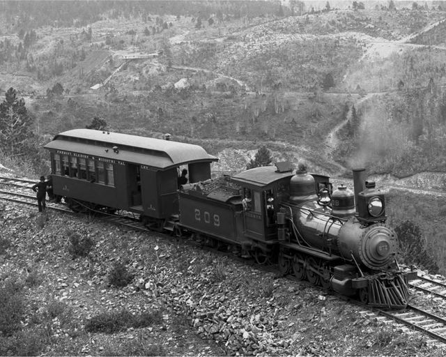
The Fremont, Elkhorn & Missouri Valley Railroad began in 1869, creating some of the longest lines in the state, including the now-abandoned Cowboy Line between Norfolk and Chadron, NE. The company also expanded into Wyoming and South Dakota, especially in the Black Hills area.  Image: Fremont Elkhorn & Missouri Valley 4-8-0 Mastodon Above Nevada Gulch on the Portland Line (circa 1900)   The larger  Chicago & Northwestern Railway  acquired the company and completely integrated the system in 1903. Most of its rights of way have since been abandoned, but the line north of Chadron, NE remains in service to this day.

The Embarcadero Freeway: A San Francisco Disaster

Image
The Embarcadero Freeway , also known as CA-480, was a freeway located in San Francisco, first constructed in 1959. Planned to be part of the Interstate Highway System, originally proposed as a connection to US 101 and US/40-50 in 1947, the Embarcadero was proposed as I-480. When it became clear the entire freeway wouldn't be built, the I-480 designation was removed, converting it into a State Highway. View of the freeway, facing north near Howard Street. ( America's Canceled Highways )  According to the Congress for New Urbanism, "San Francisco's Embarcadero Freeway was originally designed to connect the Bay Bridge and the Golden Gate Bridge but was never completed. The Embarcadero only succeeded in cutting off the city from the waterfront and running long ramps deep into the neighborhood fabric. In the most used sections, traffic on the Embarcadero reached well past 100,000 vehicles per day." Image: SF Chronicle , "Vista views of a section section of the Emb...

Railcars in Storage

Image
The US railroad network is an engineering marvel. And just as important to the industry as the rails themselves are its rolling stock. After all, without railcars, the rails would be nothing but iron. But the demand for railcars is not constant, and different kinds of cars are needed at different points of the year. While the exact number of railcars in service in North American railroads and holding companies isn't known, it's about 1.6 million. On any given day however, about 900,000 won't move . While many of these are simply waiting in large railyards, many more are redundant at certain points of the year, and yet will be needed in the future. Thus, there is a market for train tracks to hold excess cars. While many of these can be stored away in yards, an alternative to placing a line out of service or abandoning it outright is to lease the space and store railcars and other rolling stock on it. However, the practice isn't without controversy. Some of these c...

The Straightest Abandoned Track in the US

Image
Railroad lines attempting to brave the terrain of the Rocky Mountains meant that some of the tightest curves ever in the US railroad network were located in the State of Colorado . DRGW 207 at Alamosa, CO. Fireman's Side of Engine, 1907. Image: NG Train Pics But that doesn't mean every railroad line meanders about in the State. Ironically, one of the longest straight (tangent) sections of track was also located in Colorado, along a Denver & Rio Grande Western Railroad line running between Alamosa and Poncha Springs, CO, known as the Valley Line . DRGW.net describes the Valley Line as such, "The original part of the Poncha Pass route, from Mears Junction (joining with the Marshall Pass main line) down to Orient, was initially constructed along with the mainline in 1881. Nearly a decade later in 1890, the line was extended down from Villa Grove to Antonito, CO, where it connected with the existing the existing narrow gauge lines: La Veta Pass, the Antonito Branch, and...

The Amstutz Expressway: Lake County's "Road to Nowhere"

Image
Freeway proposals don't always work out, as this site has discussed with both New York City and Chicago's  abandoned expressway proposals. Still many others are built, but not in the entirety their planners originally envisioned them to be. Such is the case of Lake County, Illinois' Amstutz Expressway, one of the shortest and least traveled limited access freeways in the Chicago area. Image: Amstutz Expy under Grand Ave. Google Maps A Lakefront highway proposal had been planned since the very early part of the 20th century in eastern Lake County. Generally, early proposals had the road continuing to near or even beyond the Wisconsin State Line. During the early 1970's, the North Amstutz was completed between Greenwood Ave and Sheridan Rd, where it remains to this day. So how exactly did we get here, and what is the future of this road? Looking south at the north end of the Amstutz. Image: [jonrevProjects] Planning and Design: The main purpose f...

The Oregon California & Eastern Railway

Image
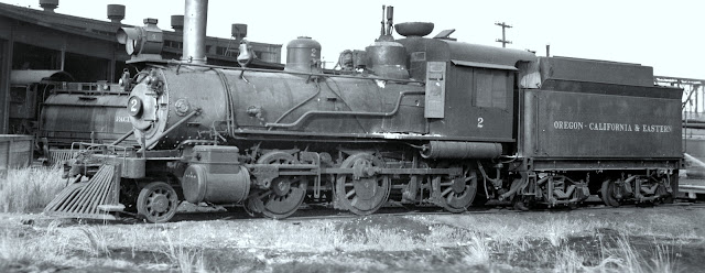
The Oregon, California & Eastern Railway ran between Klamath Falls and Bly, OR along a 64 mile right of way . Like most logging railroads, it also incorporated numerous spurs, some of which were quite lengthy themselves. Oregon California & Eastern no. 2 . Robert Graham Photo. The line began in 1919 by acquisition of the Klamath Falls Municipal Railway , running 20 miles to Dairy, reaching Bly in 1927. The initial goal of the route was to build it, connect to other major railways, and ideally sell it to a larger road, with the one in mind being the Southern Pacific Railroad, with whom it connected to at Klamath Falls.  In a twist of fate, the Southern Pacific purchased the OC&E in 1925 but operated it as a separate entity. Three years later, a unique partnership was forged when the Southern Pacific sold a half-interest in the OC&E to the Great Northern Railway. This arrangement led to an alternating operation of the railway between the two companies, each taking tu...